Glencoe - Route
- Super User
Warning - Glencoe is serious mountain country and is not for the inexperienced. This section of the Way is one of the most challenging due to the amount to hill to climb and traverse. There is steep ground to be crossed, rock steps to be avoided and forest to be gone through. Navigation by map and compass is essential.
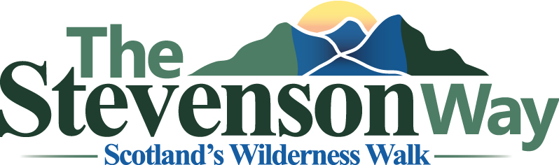
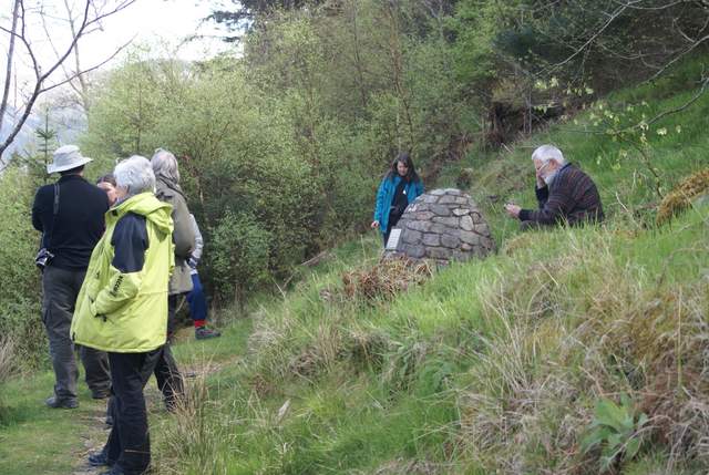
Start by visiting the site of the murder of the Red Fox (NN032596) and then on to the site of the hanging of James of the Glens (NN053597).
The cairn where Colin Roy Campbell was shot and murdered: Where James of the Glen was hung (on a scaffold 10m high):
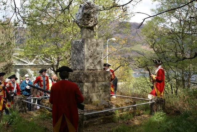
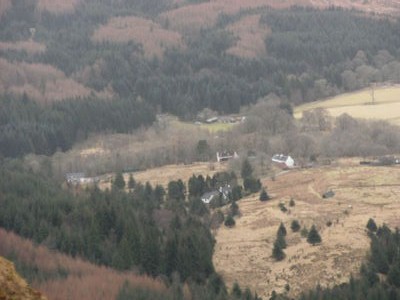
In the book David and Allan went up the hillside above the scene of the murder and doubled back to avoid the Redcoats. However the hillside above the Wood of Lettermore is very steep and has a deer fence. So the best route is to start in the forest walks at South Ballachulish (NN047588) and then take the forest drive round to the radio mast above the murder site. That's the easiest part over! Now you need to traverse the mountain side at around the 300m contour line until you are above Kentallen. The views across Loch Linnhe are wonderful which makes up for the very steep and tricky ground that you are crossing. There are many streams and gullies which need to be tackled with care. Once you are above Kentallen you need to start descending to the old railway at NN004564. On no account attempt to carry on along the hillside beyond Kentallen as you will encounter a very steep and impassable gorge, with crags and a quarry below as well.
Above the Wood of Lettermore: Looking down on Duror:
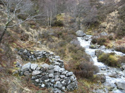
Follow the old railway into Duror and continue on to the "House of Fear", Acharn (NM998550), which unfortunately is just a ruin now. From there you can follow the "Last Clansman Trail" up Glen Duror to the birthplace of James of the Glens (NN021539). This now a bothy run by the Mountain Bothy Association and is a good place to spend the night.
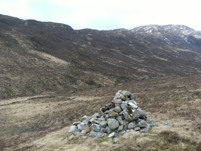
From the bothy you need to head to the top of Glen Duror and over to the cairn at the junction of the path at NN069549 in Gleann an Fhiodh. Please note that the forest here is a working forest and you may have to detour via other paths/tracks to avoid the timber harvesting operations.
This may happen, so beware! Looking south-west from the cairn:
From the junction of the paths cross the river and take the path heading south-west over to Glen Creran and descend until you meet a forestry road. Turn right and follow it for a couple of kilometers until you find a small track NN057517 heading down the hill. Follow this to the end and then enter the forest along the line of the stream until you reach another forestry road at NN062514. This section of forest down to the forestry road is mature and is not too difficult to walk through - it is actually quite pleasant with lots of colour, albeit boggy as well.
Turn left onto the forestry road and follow this all the way to the end and continue on when it becomes just a track. Beware of forest operations on this road as well. At the end of the track NN091518, go right and downhill until you reach a deer fence. Then turn left and follow it for 0.5 km to the stile NN095513. You are now about to enter some remote and difficult terrain.
Looking up Caol Creran: Looking to Beinn Maol Chaluim:
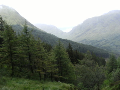
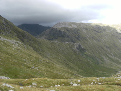
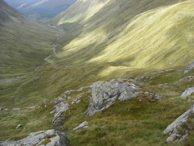
Follow the Caol Creran river until you reach the bealach at NN111506. From here you can see Loch Etive, Creise and the back of Buachaille Etive Mhor. Continue uphill to NN118513 where you will be able to see Beinn Maol Chaluim and Bidian nam Bian (the highest mountain in Argyll) beyond it. The next section is tricky as you have to make your way across to the cliffs above Bealach Fhionnghaill and then down the rock steps on the other side into Fionn Gleann. Do not take too high a line as it is very steep ground - drop down and then follow a line of small boulders uphill - in the middle of the photograph on the right, above. You are aiming for NN128524
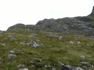
Keep to the eastern edge of the rock steps as you descend into Fionn Gleann as there are several grassy sections to assist you.
Looking down into Fionn Gleann: Looking back up the rock steps:
There is a faint path, about 100-200m uphill on the west side of the river, which you follow and then descend to NN121553 where you will find a gate. Go through this and then head down towards the river where you will find a bridge across it. Head north to the A82 and as you go along it look out for the other "Kidnapped Rock" to the right. Notice that it is easy to see if anyone is on top of it!
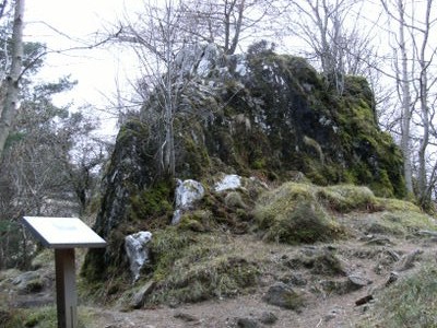
The next main point on the way is Signal Rock NN121567, by the world famous Clachaig Inn, where the pair slept overnight and then spent a day dying of thirst while the Redcoats searched for them. From here take the old road to Glencoe village and pick up the track leading up to the Pap of Glencoe which is worth the extra climb to get to the top of. However the route passes the col NN127591 between the Pap and the descent from the Aonach Eagach Ridge and down steep heather slopes to the Coire na Ciche. This is the place where the real Allan Breck hid from the Redcoats and there is the ruins of an old bothy hidden in the glen at NN133601 which might be the actual place that he stayed. The descent from the col is hard going through deep heather and steep slopes. However coming across the lovely steep sided gully towards the bottom is well worth the effort.
Signal Rock: Old bothy in Coire na Ciche:
From here the Way turns east towards Rannoch Moor - see the next section.